
Banjiuguan Fm
Type Locality and Naming
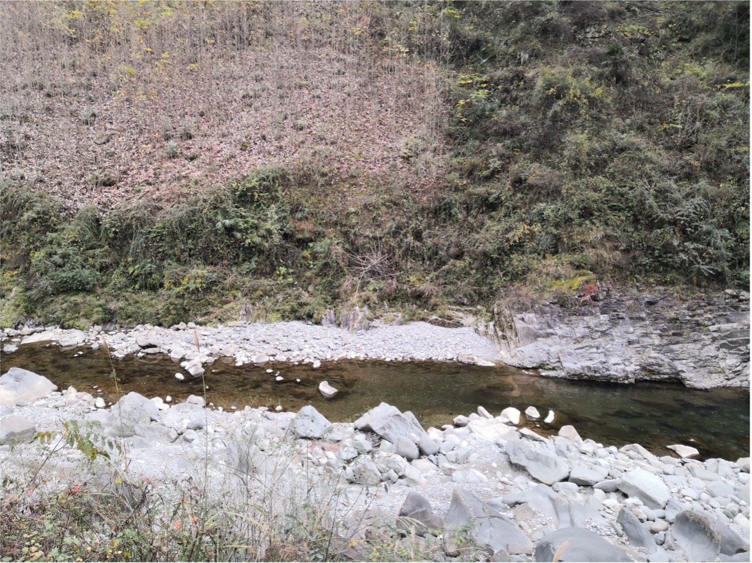
It was named by Xiang Liwen, Lin Baoyu and Nan Yunshan in 1960, and published in Paleontology Atlas of Qinling in 1963. The type section is located at Banjiuguan, Huishuiwan Town, Ziyang County, Shaanxi Province. The reference section is at Bajiaokou in Ziyang County. Coordinate: 89°53′48″E, 32°19′N. The reference section is at Bajiaokou in Ziyang Xian. Wang Jian et al. measured a new section from Jieling Town, Ziyang Xian in recent years, which is exposed well along a small river side with the coordinate of latitude 32°16′51.53″N and longitude 108°27′25.72″E (by personal communication, Figure).
Synonym: (斑鸠关组)
Lithology and Thickness
It is dominated by black thin-to-medium-bedded carbonaceous slate, carbonaceous siliceous slate, interbedded with sandstone and volcanic rocks. The thickness of the formation is 135 m at the type section.
[Figure. The Banjiuguan Fm. at Jieling Town, Ziyang Xian (Photography by Wang Jian )]
Relationships and Distribution
Lower contact
The Formation is conformably contacted onto the underlying Quanhekou Fm or Donghe Fm [But neither are in Ordovician lexicon entries; and Maliushuwan Fm is the next older regional formation and has a conformable upper contact to this same Banjiuguan Fm.]
Upper contact
The Formation is conformably contacted with the overlying Doushangou Fm or Meiziya Fm.
Regional extent
It is widely distributed in three main areas that stretch from NW-SE, i.e., from Gaoqiao of Ziyang County to Guanyuan of Langao County, from Bajiaokou of Ziyang to Maixijie of Langao, and from Huangutan of Ziyang County to Zhuxi County of Hubei Province. The thickness is various from place to place: 664 m thick at the Pijiaba section, 135 m at the Banjiuguan section, and 230 m at the Tiefu section, Langao County. The volcanic rocks are intercalated with the sedimentary rocks rhythmically in the area from Ziyang County to Huangutan, and the thickness can be up to 1000-1600 m.
GeoJSON
Fossils
The formation contains abundant graptolite, Dicellograptus complexus in the lower part and Metabolograptus persculptus, Pristiograptus leei and Cyrotograptus sarkmaricus in the middle-upper part.
Age
Depositional setting
Additional Information
The Daguiping Fm and the Banjiuguan Fm are in consistent with each other in the lithology, fossil assemblage and the distributed area. The Maliushuwan Fm is defined mainly by the Fossil Group or chrono-stratigraphy. Consequently, the names need revised when further investigations conducted according to the nomenclature rule of lithostratigraphic units.